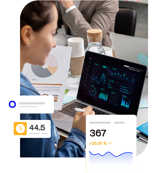
Gain Deeper Insights with Our Geospatial Analytics Services
We utilize a range of powerful tools, including Tableau, Google Maps, QGIS Python, to help businesses unlock the potential of their geospatial data.

Make the most of our geospatial analytics services to optimise your data
Whether you need to analyse customer locations, track assets, or monitor environmental conditions, we have the expertise and tools to help you achieve your goals
Geospatial data analysis is a critical service for businesses and organizations looking to extract insights and value from their geospatial data. Here are some key geospatital data service offerings we provide in geospatial data analysis:
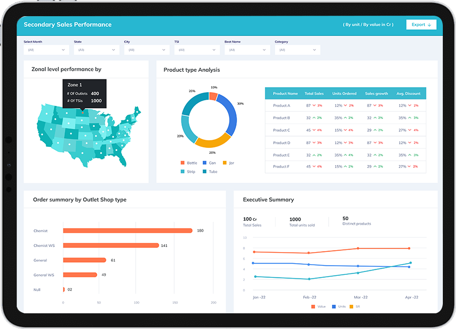
Our Geospatial Analytic Services

Geospatial Data Acquisition
This involves collecting data from a range of sources such as GPS, satellite imagery, social media platforms, and other spatial data providers. We work with clients to identify the most relevant data sources and collect data in a way that is appropriate for the intended analysis.

Geospatial Data Management
We help clients manage and organize their geospatial data effectively. This includes cleaning and processing data, ensuring data accuracy, and making sure that data is stored in a way that is easy to access and use for analysis.

Geospatial Data Analysis
Our team of geospatial analysts uses advanced statistical methods and machine learning algorithms to analyse geospatial data. This includes identifying patterns and trends, performing spatial analysis, and creating custom models to predict future events or trends.

Geospatial Data Visualization
We use a range of visualization tools such as QGIS, Tableau, and custom web-based applications to create interactive maps, dashboards, and reports that enable clients to explore and understand their geospatial data more effectively.

Custom Geospatial Solutions
We work with clients to develop custom geospatial solutions that meet their specific needs. This includes developing custom applications, integrating geospatial data into existing systems, and providing consultation on how to make the most of geospatial data.
Overall, our geospatial data analysis services help clients to gain deeper insights into their data, optimize their operations, and make more informed decisions.
Geospatial Inhancement

Cesus Geographical Data Enrichment

Custom Sales Territories
Interaction Maps

Logistic Dispatch Analytics

PIN Code
Begin Your Geospatial Journey!
Let Our Geospatial Analytics Services Help Your Build a Scalable Data Infrastructure!
Contact Us Today